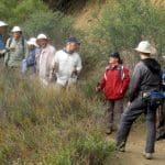
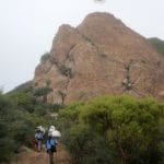
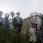
December 22nd – Long Canyon, Oak Canyon, Montgomery Canyon, Challenger Park, Coyote Hills Park, Canyon View Trail Loop
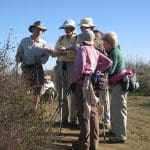
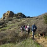
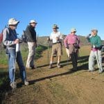
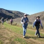
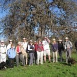
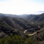
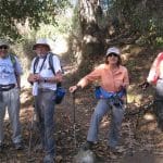
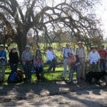
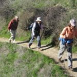
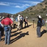
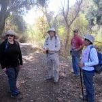
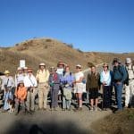
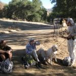
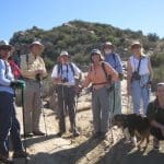
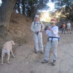
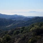
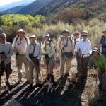
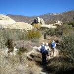
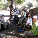
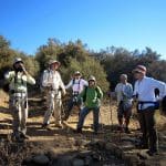
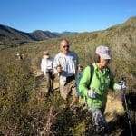
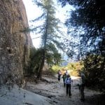
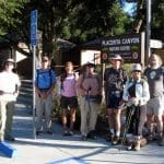
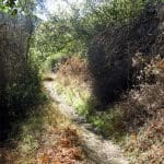
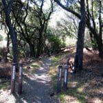
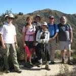
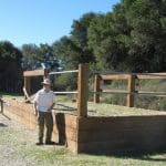
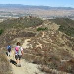
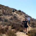
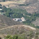
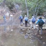
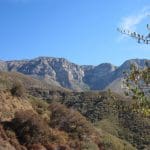
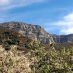
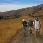
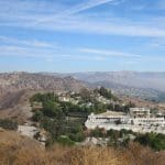
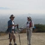
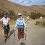
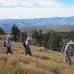
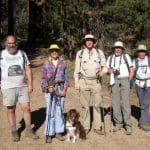
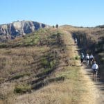
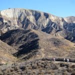
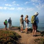
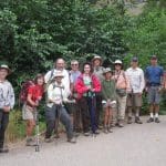
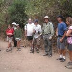
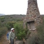
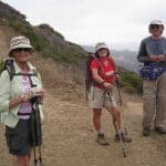
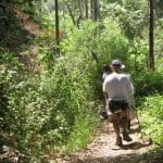
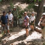
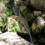
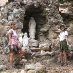
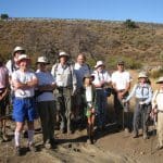
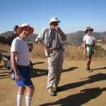
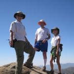
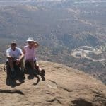
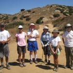
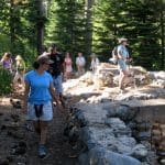
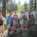
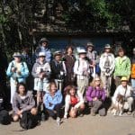
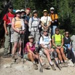
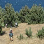
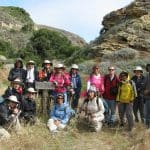
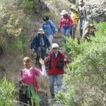
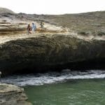
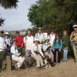
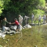
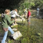
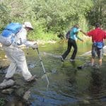
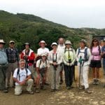
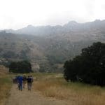
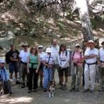
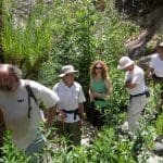
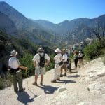
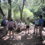
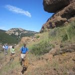
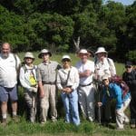
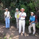
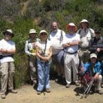
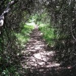
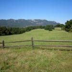
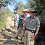
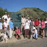
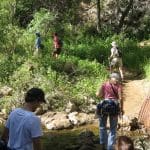
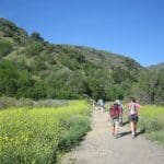
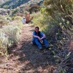
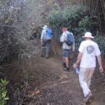
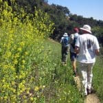
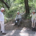
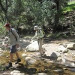
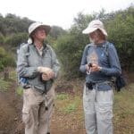
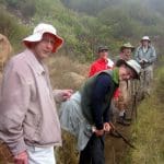
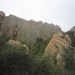
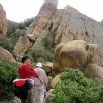
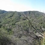
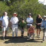
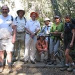
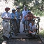
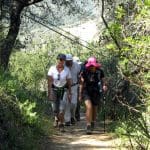
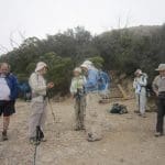
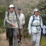
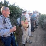
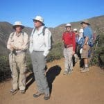
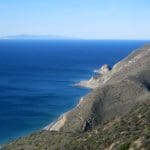
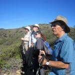
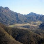
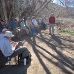
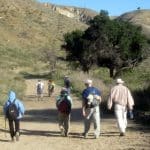
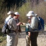
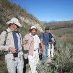
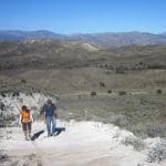
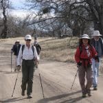
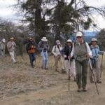
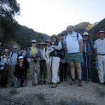
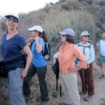
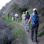
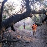
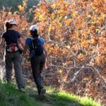
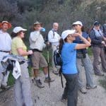
Frost was evident as 13 hikers (+ 1 dog) traveled to the trailhead parking lot on a cold, but clear, morning. Eager to warm up, we began hiking the Long Canyon trail as it climbed steeply 0.7 mile to a trail junction atop a ridge overlooking western Simi Valley to the north as well as the Lang Ranch Open Space to the south. We then followed a “use” trail down to the dirt road in Oak Canyon while enjoying views of hillsides sporting new bright-green grass. After a short break we headed up a dirt connector road to a ridge that provided 360-degree views of western Simi Valley. We continued along the dirt road as it dropped into Montgomery Canyon and then followed unmarked trails to Challenger Park. After crossing Long Canyon Road, we climbed steeply up the Canyon View Trail which provided excellent views of the surrounding area including Bard Reservoir and followed it along a ridgeline back to the trailhead parking lot, completing a 7.2-mile loop hike with 1,580’ of elevation gain/loss on a pleasant day for hiking.
December 15th – Work Party – The North Ridge Trail
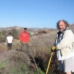
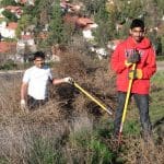
Four individuals turned out to work on the North Ridge Trail for the December 15 work Party. The Newsletter stating that the meeting location was at the North end of the trail on Evening Sky Drive was in error and caused some confusion. Work was needed on the South end of the trail starting at the Yosemite Ave./Flanagan Drive trailhead.
The weather was great, sunny and cool but it had rained on Friday and the clay soil stuck to our boots. At the first assent of the trail we encountered a lot of Tumbleweed crowding the trail. The large bushes were removed, pushed off-trail and stomped on so they wouldn’t blow away. There was already a lot of new grass growth on the trail and in places had to be cut away. Other work involved removing the many dried stalks of Mustard that grew alongside and were overhanging the trail. We made good progress and cleared about three quarters of the portion of the trail from the Yosemite/Flanagan trailhead to the Geronimo Ave. trailhead. The remaining quarter is mostly clear.
Many thanks to the following workers:
Bart Hibbs, John Sabol, Janev Veettil and his son Athul Janev.
December 8th – 2012 Holiday Party
The 2012 RSTB Christmas Party was again hosted by Ursula Christie at her lovely home. Dozens of Trailblazers attended the potluck party dinner and enjoyed a wide variety of tasty appetizers, entrees, and desserts — and wine! More importantly the gathering offered the opportunity to catch up on the past year with friends, to swap tales of past Trailblazer experiences, and to discuss potential future adventures. Glad to be members of the Trailblazers “family,” everyone had a wonderful time. Thanks again to Ursula for her hospitality.
December 8th – Cheeseboro Canyon – Palo Comado Canyon clockwise Loop
14 hikers (+ two dogs) carpooled to the Cheeseboro Canyon trailhead in the Simi Hills on a gorgeous fall morning. The hike began on the Modelo Trail as it rose to the north from the main parking lot along a ridge, providing views of the rolling countryside under a clear blue sky. Soon the trail headed west on the Palo Comado Connector trail, passing a couple of horse ranches whose four-legged residents curiously watched our passage. Heading north along the wide dirt road in Palo Comado Canyon (PCC), we passed through a grassland dotted with occasional stands of large gnarled oak trees; the road was bordered by bright green grass stimulated by recent rain. Soon after the PCC Road began its climb toward China Flat, we followed a narrower dirt trail that led up to an overlook of Palo Comado Canyon to the south. We shared our overlook perch with a group of bicycle riders. After a short break to rest, snack, and enjoy the view, we headed east, descending toward Shepherd’s Flat at the north end of Cheeseboro Canyon and passing the abandoned Sheep Corral along the way. Turning southward, we headed down through always lovely Cheeseboro Canyon, first passing through terrain dominated by chaparral and striking rock formations and then through a riparian woodland at Sulphur Springs. We continued southward, passing through a dense oak woodland and then through an open grassland, eventually reaching the parking lot, having completed a 10.4-mile hike with 1,255’ of elevation gain/loss on a great day to be outside.
December 1st – Simi Peak from the Long Canyon trailhead via the Albertson Motorway and China Flat
It was a dark and stormy morning… Six intrepid hikers, and two dogs, took full advantage of the short-lived break in the storm today. Visibility was poor at best, with the almost constant light drizzle. We enjoyed a dry lunch at the top, with the sun trying ever so hard to break through, if even for a moment. The expansive views from trips past, were nowhere to be found. Paul Simon’s “slip slidin’ away” lyrics were stuck in our minds, especially on trail sections just before the peak. The mud was sticky too, and would often add an inch or so to our height. Everyone was sure footed, so aside from our muddy shoes, we stayed clean, but damp. It was a pleasure to returning to the trailhead, having hiked 10 miles, with 2,500’ of elevation gain/loss.
November 24th – Las Llajas Canyon, Rocky Peak Fire Road, and Chumash Trail clockwise Loop
16 hikers (+ 2 dogs) met at the Las Llajas Canyon trailhead on Evening Sky Drive in Simi Valley on a warm breezy autumn morning. The hike began by descending a short paved section of road into the canyon bottom; from there a wide graded dirt road followed a stream north through the canyon, crossing the streambed three times; the stream was dry. The steep canyon walls provided shade as we enjoyed an easy 3.5 mile trek up the canyon. Two hikers turned around before reaching the trail/road junction just short of the Poe Ranch gate and returned to Evening Sky Drive the way they had come (as did a third hiker a while later). The remaining 13 hikers (+ 2 dogs) took the right (east) fork and continued up the dirt road leading to an abandoned oil field and then on up to a junction with the Rocky Peak Fire Road, savoring the great views along the way. After reaching the Rocky Peak Fire Road, we turned right and headed south toward the upper end of the Chumash Trail. Along the way we passed Fossil Hill (named for the shells of sea creatures left behind when the area was under a vast sea) and a number of bicycle riders. We enjoyed the panoramic views of mountains and canyons to the east, south, and west. Upon reaching the upper end of the Chumash Trail (adorned by a new sign proclaiming “Chumash Trail 2.7 miles to Flanagan Drive trailhead”), we stopped for a rest/lunch break and then rapidly descended the familiar trail encountering several horseback riders along the way. We then turned right (west) and followed a short trail to a closed, but not locked, gate in a fence at the east end of Evening Sky Drive. A short walk along Evening Sky Drive took us back to our vehicles, having completed a pleasant 9.6-mile hike with 1,793’ of elevation gain.
November 10th – Sulphur Mountain Shuttle
10 hikers [+ one cute dog] carpooled to the paved west end of Sulphur Mountain Road (off Hwy 33) near Ojai on a clear chilly morning. Leaving two vehicles parked near the gate, several hikers began hiking eastward (uphill) on the Sulphur Mountain Recreation Trail (SMRT). The remaining hikers boarded the other two vehicles for a very scenic drive through the Ojai Valley to the eastern trailhead via Hwy 150 and the paved east end of Sulphur Mountain Road which wound pleasantly uphill through an oak forest where we spotted a deer. After assembling our hiking gear, we headed westward along the SMRT. It was a gorgeous day and we were treated to sweeping views of the beautiful rolling green terrain between our trail and the ocean as well as clear views of the Oxnard Plain and several of the Channel Islands. After a couple of miles we had a rare sighting of two mountain lions, with one coyote. We continued westward with the upper portion of the Sulphur Mountain Ridge immediately to our north and continuous vistas of rolling hills dotted with oak trees, grassland meadows, and valleys to the south and west. Eventually we met our eastbound fellow hikers and exchanged car keys (thus avoiding a lengthy car shuttle). We resumed our journey, continuing to walk through the beautiful pastoral countryside. Eventually the trail began providing views of the Ojai Valley and the distant towering mountains to the north and west and of Lake Casitas to the west. The last mile of the trail wound downhill, heavily shaded by oak trees. We eventually reached our vehicles, having completed a very pleasant 10-mile hike with 400’ of elevation gain and 2,200’ of gradual elevation loss on a perfect day for hiking.
November 3rd – Piedra Blanca Trail [aka Gene Marshall National Recreation Trail] (22W03) to Twin Forks Camp
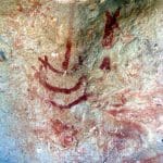
10 hikers + 1 cute dog carpooled to the Piedra Blanca Trail [aka Gene Marshall National Recreation Trail] (22W03) trailhead at the east end of Rose Valley Road (6N31 off Hwy 33) in the Los Padres National Forest north of Ojai, CA. It was a beautiful morning as we began the hike by descending to and crossing Sespe Creek, the main watercourse in the southern Los Padres National Forest; it empties into the Santa Clara River in Fillmore. While admiring the brilliant fall colors along the creek, we followed the trail as it entered the Sespe Wilderness and climbed the chaparral-covered slope to the magnificent Piedra Blanca (white rock) Formations — huge white rounded sandstone outcroppings sculpted by wind and water. We then descended to Piedra Blanca Creek and followed it upstream to the large shady Piedra Blanca Camp where we viewed pictographs created by Chumash Indians on some of the boulders. We continued on to Twin Forks Camp (the turnaround point) where large conifers provided shade along the creek which gurgled pleasantly nearby. After a leisurely picnic lunch we returned to the trailhead for the drive home, having completed a very pleasant 7-mile hike with about 2,000′ of elevation gain/loss.
October 27th – Placerita Canyon – Los Pinetos Trail
8 hikers carpooled from the Stearns Street Park-and-Ride lot in Simi Valley to the Placerita Canyon County Park in southeastern Santa Clarita Valley despite weather forecasts warning of very strong winds. Contrary to the forecasts there was no wind whatsoever as we left the Nature Center (1,550’) and began hiking briskly eastward along the Placerita Canyon Trail. The air was cool since the canyon is shaded in the early morning. The creek in the canyon was completely dry as a consequence of a dry year. After about two miles, we reached the Walker Ranch site (1,800’) and headed south on the Los Pinetos Trail, climbing steadily toward Wilson Saddle (3,100’) and the Santa Clara Divide Road. After the first steep mile or so, the trail entered a pleasant live oak forest for the remainder of the three-mile-long trail, passing Los Pinetos Spring along the way. The group enjoyed a break at Wilson Saddle which has comfortable seating and bathroom facilities, followed by a short walk to the southeast to an overlook of the San Fernando Valley (and the tops of the tallest buildings in downtown Los Angeles). The hike resumed along a short portion of Whitney Canyon Road, but soon turned northward onto an unmarked firebreak leading down toward the Nature Center. This firebreak is not a fire road; it has many steep downhill stretches as it heads to the northwest, as well as several short sometimes-steep uphill stretches. It is challenging and strenuous, particularly if one is heading up it (rather than down it as we were). Eventually we reached an unnamed trail leading down to a large water tank overlooking the Nature Center. We then descended to the parking lot via the Hillside Trail. After a lunch break by the Nature Center, we returned to the carpool point in Simi Valley, having completed a pleasant 7.6-mile hike with 1,981’ of elevation gain.
October 13th – Sisar Canyon to White Ledge
9 hikers (and one cute dog) carpooled to the Sisar Canyon trailhead on Sisar Road just north of the Summit Community on Hwy 150 between Santa Paula and Ojai in the Los Padres National Forest on a cool autumn morning. The hike began on a shaded dirt fire road (4N15) which ascended to the north along the flowing creek which provided a pleasant accompaniment – and required one careful crossing. Eventually the road turned southwestward and emerged into the sunlight as it headed ever-upward [toward its eventual end at the Nordhoff Ridge Road (5N08)]. We were treated to increasingly panoramic views of the surprisingly green hillsides of the surrounding mountains (including the Topa Topa Ridge to the north) and the Ojai Valley to the south. We encountered several hikers and horseback riders. After hiking about 3.5 miles, the trail leading to White Ledge Camp diverged from the fire road. We followed it about one mile to the trail camp which is situated between two creeks among towering conifers. After a welcome and refreshing respite at the trail camp, we retraced our steps downhill back to our vehicles and returned home, having completed a 9-mile hike with a total elevation gain/loss of about 2,000’.
October 6th – Ahmanson Ranch – Lasky Mesa
13 hikers (+ Heidi, a cute dog) carpooled to the Upper Las Virgenes Canyon trailhead at the north end of Las Virgenes Road in the Simi Hills on a pleasantly cool morning. A short distance after the hike began we reached a T-junction and turned right onto the East Las Virgenes Canyon Trail (ELVCT), a well-maintained dirt road that winds through the Upper Las Virgenes Canyon Open Space Preserve (aka Ahmanson Ranch) to the Victory trailhead at the west end of Victory Blvd in West Hills. The preserve consists of a vast expanse of rolling hills and grasslands dotted with large old oak trees. A short distance along the ELVCT we turned right and followed an unnamed dirt road as it rose to Lasky Mesa which is named for Jesse L. Lasky, a key founder of Paramount Pictures. A number of famous movies were (partially) filmed here, including the sunrise scene in Gone with the Wind in which Scarlett O’Hara declares “As God is my witness, I’ll never be hungry again.” Heading north along Lasky Mesa we ascended to an overlook that provides a panoramic view of the San Fernando Valley (smog permitting). Descending past the Victory trailhead we rejoined the ELVCT and headed southwest to a connector trail that took us northwest to the Las Virgenes Canyon Road which we followed southeast along Las Virgenes Creek (headwaters for Malibu Creek), back to our cars. We then returned to Simi Valley having completed an 8-mile hike with over 1,000’ of elevation gain/loss. NOTE: Refer to the following web site for an excellent and very interesting history of the Ahmanson Ranch (and surrounding) area: http://www.moviesites.org/laskymesa.htm.
September 29th – Mt. Pinos to the Lockwood Valley Shuttle
Six hikers and Heidi (a dog) carpooled to the hike’s end point at the gate on Boy Scout Camp Road in Lockwood Valley, dropped off a shuttle vehicle, and then drove to the trailhead at the Chula Vista parking lot on Mt. Pinos Road. The hike began on a beautiful cool morning by following a dirt road through the forest to the Tumamait-Mt. Pinos Trail (21W03) trailhead at the Condor Observation Point (8,831’) where there were excellent views to the south and west. A well-maintained dirt trail then entered the Chumash Wilderness as it descended the open western slope via switchbacks; it then crossed a saddle and ascended the forested eastern slope of Sawmill Mountain. We then followed a faint side trail to the Sawmill Mountain peak (8,818’), marked by a large cairn. Returning to the main trail we descended to a junction with the North Fork Trail (22W02) which we followed as it descended southward half a mile to Sheep Primitive Camp (8,200’) under a stand of Jeffrey Pines. Continuing on we descended 22W02 through lovely forest to Lilly Meadows (6,500’) and then on down to the dirt road leading to Camp Three Falls (5,400’) and our shuttle car, passing several backpackers (including some boy scouts) along the way. We then retrieved the car left at the Mt. Pinos trailhead and returned home having completed a pleasant 10.9-mile hike with 957’ of elevation gain and 3,435’ of elevation loss.
September 1st – Big Sky Trail Loop
Fifteen Trail Blazers met at Big Sky Place at 8 AM this morning. It was unusually cool the night before, so we enjoyed comfortable hiking temperatures, until the very end of the hike. Although it was just under 80 degrees when we returned the trailhead, the high humidity made it feel much warmer. The elevation gain part of the loop was complete before the temperature started to rise. It was a relatively clear day, so we were presented with some fine views for the first half of the hike. The whole hike took about 2 hours, so we were done well before the activities of the holiday weekend began. The loop was 4.4 miles, with 950’ of elevation gain.
August 25th – Westwood Beach to Paradise Cove
Seventeen hikers carpooled to the far end of Westward Beach Road, just north of Pt. Dume Sate Beach. Our hike quickly gained elevation, as we hiked the trail to the north of the Point, on our way to a well used stairway taking us to Pt. Dume Cove Beach. It was overcast when we arrived, but by 10 AM, the skies cleared in time for us to enjoy the ocean views. Temperatures were in the comfortable range, as we walked along the beach to Paradise Cove. As always, Paradise Cove was a most inviting place. We relaxed in the Adirondack chairs, eating our trail snacks, taking in the ocean view, enjoying the sounds of the waves, and watching the busy seagulls create ever more tracks in the sand. On our way back, we saw many pods of dolphins, from observation point to the south of Pt. Dume. Along the beach, all the way back to our cars, we continued to see even more dolphin pods. We all had a most enjoyable hike, completing the 7.1 mile trek (with 650’ of elevation gain), knowing that we would soon return to the ninety degree temperatures back in Simi Valley.
August 18th – Mugu Peak La Jolla Valley Loop
In this latest installment of the new RSTB Network’s reality show “Beat the Heat”, eleven happy contestants met at the La Jolla Canyon trailhead, in Pt. Mugu State Park. The object of this week’s show was to beat the mid-nineties heat in Simi Valley, while hiking the 9.2 mile (1.685’ elevation gain) loop. All contestants won the grand prize of 76 degrees when they returned back to the trailhead later that morning. Eight lucky contestants won the bonus round, also completing the trek to the top of Mugu Peak. Stay tuned for next week’s “Beat the Heat” show, when more contestants will to complete the Westwood Beach to Paradise Cove out and back.
August 11th – Carpinteria Bluffs and Seal Sanctuary
10 hikers met in the parking lot at Rincon Park a little south of Carpinteria to escape the triple-digit heat forecast for the inland valleys. Our hike began along the Carpinteria Bluffs overlooking Bates Beach and the Pacific Ocean. The trail ran parallel to the railroad tracks for about a mile and a half and then led through a grove of eucalyptus trees over to the Carpinteria Harbor Seal Preserve which is home to almost 100 adult seals who give birth to their cubs on the Carpinteria shoreline; it’s one of the four harbor seal rookeries remaining along the southern California coast. Alas there were no seals in the sanctuary. However, we did spot several seals in the ocean during the hike (their heads were visible). After reaching Tar Pits Park with its naturally occurring asphaltum, we took a break nearby and enjoyed the mild temperature and the ocean and beach views. As we returned, we descended to Bates Beach for a leisurely sandy stroll beside the ocean back to the picnic area at Rincon Park. We then returned to a very hot Simi Valley, having completed a refreshing 4.8-mile hike with about 150’ of elevation gain/loss.
August 4th 2012 – Solstice Canyon
13 hikers gathered at the parking lot near the mouth of Solstice Canyon in the Santa Monica Mountains National Recreation Area on a fairly cool overcast morning. The out-and-back hike began by following barely flowing Solstice Creek along the easy well-shaded Solstice Canyon Trail (a dirt road), taking advantage of two short trails paralleling the dirt road along the way, and reaching the Sostomo Trail after about one mile. We followed the Sostomo Trail as it climbed steadily toward a junction with the Deer Valley Loop Trail. As the trail rose we had good views of Solstice Canyon and the Rising Sun Trail across the canyon. Our shirts were soon soaked due to the high humidity, but the marine layer shielded us from direct sunlight (making the hike more pleasant). The well-maintained trail crossed Solstice Creek twice; both crossing areas were quite lovely and peaceful. After reaching Deer Valley, we followed the loop trail in a clockwise direction as it ascended the mountainside to an overlook of the Pacific Ocean. After enjoying the view, we completed the loop and then returned along the Sostomo Trail to the Solstice Canyon Trail. Turning left we walked a short distance to Tropical Terrace, the ruins of the Roberts house built in the 1950s and destroyed by wildfire in 1982. At one time there were giraffes, camels, buffalo, African deer, and exotic birds in the canyon. We took a break at Tropical Terrace, read the signs describing it, and enjoyed the ambiance of palm trees and waterfalls in the adjacent Solstice Creek. We then returned to the parking lot via the Solstice Canyon Trail – stopping along the way to view the ruins of the Keller House built in 1865 – having completed a 6.5-mile hike with over 1,400’ of elevation gain.
July 28th 2012 – The Hummingbird Trail and Rocky Peak
12 hikers met in the dirt parking area (1,120’) on the east side of Kuehner Avenue just north of Hwy 118 in Simi Valley to hike to Rocky Peak via the Hummingbird Trail. It was an already warm morning as we began our eastward climb to the Rocky Peak Fire Road. The trail passed through (and on) a variety of imposing rock formations along the way including very large boulders and giant slabs of sandstone rock, many with small “caves.” By the time we had reached the fire road (2,100’) the day had turned hot. As we followed the road northward along with a variety of bikers, runners, and other hikers, there were sweeping views of eastern Simi Valley, the Santa Susana Mountains, and the Simi Hills (including the Boeing/Rocketdyne facility). After reaching the customary viewpoint near Rocky Peak, we carefully followed a steep narrow trail over to the actual peak (2,715’) nearby. After admiring the view, we retraced our route and reached the trailhead having completed an 8.4-mile hike with about 1,750’ of elevation gain/loss. NOTE: Several hikers cut their hikes short due to the intense heat.
July 16th – July 22nd 2012 – Lake Tahoe Camping & Hiking Event
DAY 1 – Travel from Simi Valley to the Fallen Leaf Lake Campground (6,368’) at South Lake Tahoe
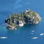
The 18 participants carpooled around 450 miles to the campground, checked in, and set up camp. The campsites were located among towering pine trees and were relatively secluded. Each campsite was equipped with a picnic table and a bear box and drinking water, flush toilets, and $1.00 showers were nearby, Around 4:00 p.m. we began hiking the Moraine Trail (6,388’) which began in the southwest corner of the campground near our campsites. The trail wound through the forest crossing Taylor Creek on a bridge and then heading south along the western shore of Fallen Leaf Lake to Sawmill Cove, passing the ruins of several homes and a lodge along the way. The lake and sky were beautiful shades of blue contrasting with the green pine-scented forest. The hike covered 2.5 miles with about 100’ of elevation gain/loss.
DAY 2 – Desolation Wilderness – Glen Alpine Trailhead (6,495’) to Lake Aloha (8,131‘)
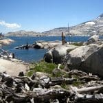
We drove slowly along the narrow road on the east side of Fallen Leaf Lake to the trailhead in the southwest corner of the lake where we obtained two free wilderness permits. We began hiking on a shaded but very rocky road, passing Lily Lake (6,550’) and Glen Alpine Springs. The road ended but the single-track trail rose steadily; it was also quite rocky. Upon reaching a fork in the trail we headed toward Susie Lake. The trail continued to climb to another junction; we again headed toward Susie Lake (7,779’). When we reached Susie Lake we decided to stop for a lunch break along the shore to enjoy the beautiful scenery. We continued on up the trail past a dazzling array of blooming wildflowers to Heather Lake (7,895’) and then ascended to Lake Aloha (8,131’) where we were greeted by spectacular views of the large lake filled by clear blue water, dotted with a myriad of tiny islands, and surrounded by white granite hillsides. The trail beside the lake is part of both the Pacific Crest Trail and the Tahoe Rim Trail. Most of us returned the way we came, completing a 12.5-mile hike with 2,397’ of elevation gain/loss. Four others continued to the southeast along the PCT/TRT eventually leaving the wilderness at Lower Echo Lake (7,414‘) where they were picked up and returned to the campground.
DAY 3 – Desolation Wilderness – Bayview Trailhead (6,922‘) to Middle Velma Lake (7,898‘)
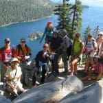
We carpooled to the Bayview Campground trailhead (near Emerald Bay) where we obtained free wilderness permits. We began hiking up the steep trail through a lush forest of white fir, lodgepole pines, and western white pines. Soon after passing Granite Lake (7,668’) we stopped at an excellent overlook that provided us with views of granite mountains, lakes, and canyons to the north and west. We continued hiking toward Middle Velma Lake as we passed through the picturesque terrain and two trail junctions. When we reached a very pretty unnamed lake (7,938’) near Upper Velma Lake we decided to stop to have lunch. Continuing our hike we soon crossed the stream between the unnamed lake and Lower Velma Lake. A short distance further on we reached a trail junction with the PCT/TRT. After stopping briefly to view Middle Velma Lake (7,898’) we headed southeast along the PCT/TRT to Fontanillis Lake (8,298’), getting glimpses of Upper Velma Lake along the way. Fontanillis Lake was very pretty with its background of bare granite mountainsides and many blooming wildflowers along the trail. Next we passed Dicks Lake (8,435’); soon after that we left the PCT/TRT and headed northeast toward the first trail junction we had encountered that morning. Reaching that junction we hiked down the beautiful-but-poorly-maintained Eagle Lake (7,004’) Trail to Eagle Falls where we ended our hike having covered 11.9 miles with 2,700’ of elevation gain.
DAY 4 – Desolation Wilderness – Mt. Tallac Trailhead (6,447’) to Mt. Tallac Peak (9,750’)
We carpooled to the Mt. Tallac trailhead near Fallen Leaf Lake where we obtained free wilderness permits. The trail rose quickly to a low ridge just west of Fallen Leaf Lake from which we had excellent views of the lake. The trail continued climbing through lush forest until reaching Floating Island Lake (7,235’) in a pretty alpine setting (but the floating island has disappeared). The trail then rose to Cathedral Lake (7,636’), a secluded glacial tarn below Cathedral Peak. The trail then began to climb in earnest eventually leading us up to a windy alpine meadow full of blooming wildflowers and providing us with spectacular views of the surrounding granite mountains. Continuing on, the trail again rose steeply as it led us inevitably to Mt. Tallac Peak which is composed of fractured granite rocks. We carefully made our way up to the peak and rested there while enjoying the unparalleled 360-degree views of the Lake Tahoe area. After a while we retraced our route and arrived back at the trailhead having completed a strenuous 10-mile hike with 3,400’ of elevation gain/loss.
DAY 5 – FREE DAY (to do as everyone pleased)
After the preceding three days of strenuous hiking in the Desolation Wilderness, everyone was happy to have a “day off.” Some of the activities that were pursued were taking a driving tour all the way around Lake Tahoe (in a clockwise direction); exploring an abandoned train tunnel near Truckee; rafting on the Truckee River [the only outlet for the water in Lake Tahoe]; bicycle riding; visiting the Tallac Historic Site; exploring the Rainbow Trail (6,300’) with its underground Stream Profile Chamber in the Taylor Creek watershed near the Lake Tahoe Visitor Center; and eating ice cream.
DAY 6 – Grover Hot Springs State Park AND Burnside Trailhead (5,927’) to Burnside Lake (8,151’)
We carpooled 36 miles southeast on Hwy 89 via Luther Pass to Grover Hot Springs State Park on a hot day. The park is three miles west of Markleeville, CA and is surrounded on three sides by mountains that rise abruptly from the valley. Since we had planned to hike first and sit in the hot springs later, we began hiking the Burnside Lake trail. After hiking an easy mile through a meadow and then forest, over half of the group decided to continue another half-mile to a waterfall and then return to the parking lot; the remainder of the group decided to continue to Burnside Lake. The next three miles of the trail leading up to the lake were steep as most of the trail’s 2,100’ elevation gain occurred during these three miles; the upper portions of the steep trail were somewhat overgrown. The last mile leading to the lake was nearly level and very pretty as it wound through forest and meadows full of wildflowers. After reaching the lake and enjoying its shady shore while watching a family of ducks forage for food, we returned the way we came. Reaching the parking lot we had completed a 10-mile hike with 2,100’ of elevation gain/loss [which the hot day and still air had made more difficult]. As planned, most of the group took advantage of the hot springs (with no sulfur smell) and the adjoining cold swimming pool, after which we returned to our campground.
July 14th 2012 – Serrano Canyon
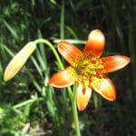
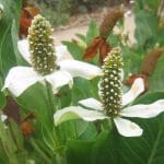
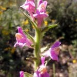
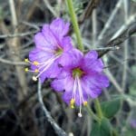
10 hikers carpooled to the day-hiker’s parking lot at the Big Sycamore Canyon Campground on Pacific Coast Highway in Point Mugu State Park. The hike began by walking through the campground and then hiking 1.1 miles north on the dirt Sycamore Canyon Fire Road (which we shared with bicyclists). We then headed 1.7 miles east on the Serrano (“from the mountains”) Trail as it climbed gradually upstream through the beautiful shaded canyon. We enjoyed a few late-blooming wildflowers along the trail, including the orchid-like Humboldt’s lily; lots of poison oak provided a festive red and green touch. We encountered several small groups of hikers including some cub scouts. We emerged from the canyon into lovely Serrano Valley which is ringed on all sides by mountains; it consists mainly of large meadows covered by wild grasses and dotted with a few trees and some bushes along the seasonal streams. There we began hiking the Serrano Valley Loop in a clockwise direction, stopping briefly to examine ranch artifacts such as an old water pump and an old abandoned car frame. The west side of the loop climbed part way up the mountain to a fork in the trail where we turned right and followed the now-faint trail as it climbed into the foothills along the north side of the loop [the left fork would have taken us to the Old Boney Trail]; it provided great views of the towering mountains to the northeast. Soon the trail began descending along the east side of the loop affording us with excellent views of the western part of Serrano Valley and the mountains to the south. Refreshed by cool ocean breezes, we completed the loop and then descended through pleasantly cool Serrano Canyon to Big Sycamore Canyon where there were surprisingly few bicycle riders and virtually no other hikers. We returned downstream to the parking lot at the campground, said our goodbyes to our friends, and returned to Simi Valley having completed an 8.7-mile “lollipop loop” hike with 1,141’ of elevation gain/loss on a great day for hiking.
July 7th 2012 – Mt. McCoy to the Reagan Library
At 8 AM this morning, ten hikers arrived at the Donut Delite parking lot, before walking up to the Mt. McCoy trailhead. It was a cool morning, just perfect for the many switchback climb ahead of us. From the top, we could see the heavy marine layer to the west. To the east, the view was clear and unobstructed. Arriving the Reagan Library, the group split up and went exploring. Some of us spent our time inside, others enjoyed the gardens, and still others tried to walk around the whole library, discovering the F14-A aircraft on the north side of the Library. We returned to our cars, before the heat of the day caught up with us, having completed a 6 mile trek with 800’ of elevation gain.
June 29th – July 2nd 2012 – Santa Rosa Island Backpack
FRIDAY, JUNE 29, 2012 – Travel to Santa Rosa Island, backpack to Water Canyon Campground, walk on Water Canyon Beach, and hike the Torrey Pines Trail – 7.1 miles w/700’ elevation gain/loss
Sixteen eager hikers assembled around 7:00 a.m. at the Island Packers facility in Ventura Harbor with their backpacking, hiking, and camping gear, looking forward to exploring Santa Rosa Island, one of the more remote of the five islands in the Channel Islands National Park. By 8:00 a.m. all passengers and their gear were aboard the boat and the journey began. The boat ride was somewhat rough since there was a strong oncoming wind. Once we were in deeper water in the Santa Barbara Channel, we spotted many seals and Anacapa Island was visible to the south. After dropping quite a few passengers off at Scorpion Harbor on Santa Cruz Island (the largest of the Channel Islands), the boat continued along the south side of 22-mile-long Santa Cruz Island to the new pier on Santa Rosa Island (the second largest island). We were greeted by a volunteer-host couple on the pier and were told that the campsites in the Water Canyon Campground were first-come first-served. After strapping on our backpacks we hiked 1.5 miles (with only 175’ of elevation gain) along the Coastal Road to the campground where we selected four campsites and set up our tents. The campground had two very nice bathrooms with running water and one solar-heated shower as well as a view of the surrounding mountains and the ocean. Taking advantage of the beautiful day, we hiked over to Water Canyon Beach in Bechers Bay and strolled along its lovely white sand while admiring the beauty of the ocean and the bay. Next we followed the Coastal Road to the Torrey Pines Trail trailhead. The Torrey Pine is the rarest pine species in the United States, growing only on Santa Rosa Island and in San Diego County. We followed the trail as it climbed several hundred feet uphill and wound through the long-needled trees, providing spectacular views of forest and ocean. 20-plus mph wind made it difficult to sleep that night despite a wooden wind shelter at each campsite.
SATURDAY, JUNE 30, 2012 – Hike from Water Canyon Campground to/thru Lobo Canyon to the ocean [and back] – 8.5 miles [to 12 miles] w/600’ [to 1,100’] elevation gain/loss
After breakfast the entire group began hiking along the Coastal Road toward Smith Highway. As we reached the air strip we encountered a vehicle occupied by the volunteer-host couple who offered to transport us (in two trips) to a point close to Lobo Canyon. Most of us accepted their offer, but four individuals hiked the entire distance to the trailhead. Once we were all assembled at the trailhead, we began our descent through Lobo Canyon to the ocean. The canyon provided stunning scenery including many moss-draped trees, wind-sculpted rock formations, and a plethora of beautiful wildflowers. Upon reaching the mouth of the canyon we took a lunch break and enjoyed spectacular island and ocean views. After lunch we returned the six miles to camp, following the same route we’d taken that morning and enjoyed the panoramic views of the island and Bechers Bay. Back in camp most of us took advantage of the solar-heated shower facility (a rare treat on a backpacking trip) and took it easy the rest of the afternoon. In the evening the 20-plus mph wind reappeared, but most of us slept better than the night before.
SUNDAY, JULY 1, 2012 – Hike from Water Canyon Campground to the Cherry Ridge/Canyon Trail to Soledad Road to the Black Mountain Summit to Telephone Road to the Cherry Ridge/Canyon Trail to the campground – 9.3 miles w/1,750’ elevation gain/loss
After breakfast most of us braved strong winds as we climbed up the Cherry Ridge Trail, enjoying sweeping views of Bechers Bay. However, the morning fog obscured our view of the interior mountains. After reaching a couple of small picnic tables along the trail, we descended into Cherry Canyon with its interesting rock formations, a variety of late-in-the-season wildflowers, and protection from the strong wind! Upon reaching Soledad Road we followed it inland as it rose up Black Mountain. The strong wind persisted as did the inland fog but we eventually reached the mountain peak. As we started down Telephone Road shortly after leaving the summit of Black Mountain, the fog dissipated, the wind subsided, and we were rewarded with great views of the northeast portion of the island. That night we again experienced 20-plus mph wind and slept somewhat fitfully.
MONDAY, JULY 2, 2012 – Backpack from Water Canyon Campground to the pier, hike to the Carrington Point State Marine Reserve, and leave Santa Rosa Island – 9.7 miles w/800’ elevation gain/loss
After breaking camp and leaving our backpacks on the pier [for later loading on the boat], we hiked up the bluff in the northeastern corner of the island on a beautiful day. We passed through a dazzling display of unbelievably beautiful wildflowers and, as we gained elevation, were rewarded with expansive views of the island’s seashore as well as the western end of Santa Cruz Island. Eventually we reached an overlook of the Carrington Point State Marine Reserve where we observed a pinniped (seals, sea lions) rookery. We enjoyed a pleasant boat ride with a following wind back to Ventura Harbor including great views of Santa Cruz Island (including our boat entering the Painted Cave) and the appearance of many dolphins and humpback whales. The trip was a huge success (despite the strong wind at night); Santa Rosa Island is truly a “hidden treasure” in our own backyard.
June 23rd 2012 – Wildwood Park Loop: Arroyo Conejo Creek to Hill Canyon Wetlands to Wildwood Canyon (Paradise Falls) to the Lynnmere Trail
13 hikers arrived at 8:30 a.m. at the trailhead at the northwest end of Calle Yucca on the south side of Wildwood Park in Thousand Oaks on a still-cool morning. As the hike began we descended into the shady canyon through which the Arroyo Canyon Creek runs. The trail (an old dirt road) ran through a pleasant woodland of oak and walnut trees; we crossed the creek four times by carefully stepping on rocks in the stream (hiking poles are advised) before reaching the new (2005) Hill Canyon Wetlands, home of coots, mallards, herons, and pond turtles. Leaving the wetlands, we made our final “wet” stream crossing and then hiked along a narrow trail through some tall brush soon reaching an open grassland. A quick trip over to the main stream revealed a temporary sandbag dam which we used to avoid a detour of about 1.8 miles. After passing the modern-looking Hill Canyon Wastewater Treatment Plant, we followed the trail upstream through Wildwood Canyon, stopping to enjoy Paradise Falls along the way. The trail then ascended along a fairly steep dirt road until it met the Lynnmere Trail. Taking the west fork, we followed the trail as it led us around the north side of the mountain and then climbed southward to the top of the mountain, affording us with a spectacular 360-degree view of the surrounding mountains. We then descended back to the original trailhead and headed home having completed an enjoyable 5.9-mile hike with 930’ of elevation gain/loss.
June 16th 2012 – Danielson Memorial
13 hikers met at the Madera Road carpool point on a partially overcast morning and then traveled to the Wendy Trail trailhead on Potrero Road at the south end of Wendy Drive in Newbury Park (which borders the Santa Monica Mountains National Recreation Area). The hike began by following the Wendy Trail to the Satwiwa Native American Indian Culture Center at Rancho Sierra Vista and then heading diagonally southeast across the adjacent grassland to the Danielson Road leading to the Danielson Memorial. The trail (dirt road) climbed for a while before dropping into Upper Sycamore Canyon and crossing its streambed. After taking a short side trail to a nearly dry waterfall, we returned to the main trail and followed it as it rose up Old Boney Mountain via shaded switchbacks, soon providing us with sweeping views of the northern portion of Big Sycamore Canyon and its surrounds. A variety of blooming wildflowers were in evidence. Eventually we reached the tree-shaded Danielson Memorial and the ruins of the nearby Danielson Cabin (only a chimney remains). After a lunch break in this beautiful spot, we began returning along the Danielson Road. When we reached the stream crossing, we spotted a cluster of Humboldt lilies nearby and stopped to enjoy their beauty and take photos. Continuing on to the edge of the sprawling Rancho Sierra Vista grassland, we took a different trail on its eastern side back toward the dirt parking area on Potrero Road. Reaching our vehicles, we completed a very pleasant 6.6-mile hike with 1,365’ of elevation gain/loss.
June 9th 2012 – Hummingbird Trail Work Party & Cache In Trash Out Event
Thirty two people showed up at the Hummingbird Ranch trail head to paint over graffiti and pick up trash. The event was a combined effort between the Trail Blazers, local geocachers (CITO Event) and Alcoa employees. Alcoa donated the needed paint, trash bags, paint brushes and everything else we needed to get the job done. Snacks and water were also provided. The group split up into two parts, with half heading up to the cliffs and the other half to the dry waterfall. We expected to see a good amount of graffiti, but we were all surprised to see just how much graffiti there was at the higher sections of the waterfall. Again, much to our surprise, we ran out of paint. Since we has such a a large group, we accomplished more work than we expected after just two hours. We all enjoyed the event. We’ll schedule this event next year at the same time. Next time, we’ll bring twice the amount of paint.
June 2nd 2012 – Switzer Falls & Bear Canyon
Twelve Trail Blazers met at the Stearns Streep Park & Ride, on a relatively cool morning. “June Gloom” was right on schedule. On the way, and as we gained elevation on Highway 2 in the San Gabriel Mountains, we left the fog and clouds behind. This section of the San Gabriel Mountains was closed for three years, after the devastation wreaked by the Station Fire. The Switzer Falls trail opened three months before our hike. Despite the fire, the canyon was still as lush with vegetation as we remembered. The cool shade was most welcome. We hiked to Lower Switzer Falls, and then continued down Bear Canyon Creek, headed Trail Camp. The trail wasn’t in the best of shape past the falls. In many places it was completely obliterated by past storms, so a good deal of boulder hopping was required. We turned around, just before Trail Camp to return to the trailhead. The trailhead was very busy that day. There were two large groups of school children hiking the canyon that morning. It was a most enjoyable hike in a beautiful area. After a 8.8 mile hike, with 1,100′ elevation gain, we all agreed it’s good to have this trail system open again. The hike ended just at the right time, since the heat, combined with the high humidity, became quite fatiguing.
May 19th 2012 – Work Party – Chivo Canyon
Our May work party was conducted on the Chivo Canyon Trail. It was a beautiful day. Participants included Bart Hibbs, Alan Cueba, Martin DeGoey, Rick Pealer and Mike Kuhn. Thank you all for your time, sweat and effort.
May 12th 2012 – Tri-Peaks and the Mishe Mokwa Trail
13 hikers carpooled to the Mishe Mokwa trailhead at Triunfo Pass (2,100’) in the Santa Monica Mountains via Hwy 23, Mulholland Hwy, and Little Sycamore Canyon Road. As the counterclockwise loop hike began, the trail climbed quickly and then leveled out for a while before descending into Carlisle Canyon, providing excellent views of the reddish-colored Echo Cliffs (a long stretch of sheer vertical sandstone rock faces) against the green background of Boney Mountain. We took a break at Split Rock where there’s a thick mini-grove of shade trees overhanging a large broken boulder. We then followed a “use” trail eastward to Balanced Rock, a huge house-sized boulder precariously balancing atop a smaller boulder. Returning to the main trail, our hike climbed southward to a junction with the Backbone Trail (BBT) on a mesa affording great views of various peaks surrounding the area. As the day grew hotter, we followed a rocky trail to the west and north and ascended to Tri-Peaks (3,010’). While there we explored an interesting cave formed by huge boulders. Returning to the BBT, we followed it to Sandstone Peak (3,111’), aka Mt. Allen, the highest peak in the Santa Monica Mountains. The peak is just a hunk of grayish-white rock, but it provides a stunning 360-degree view (depending on the air quality) of the ocean, the mountains, and the Oxnard Plain; visibility was only fair on this day. We continued eastward on the BBT to a junction with a short connector trail which led us again to the Mishe Mokwa Trail; we descended to the parking lot having completed an exhausting (due to the heat) 8.3-mile hike with ~2,000’ of elevation gain/loss.
May 5th 2012 – Backbone Trail Part 8: Trippet Ranch to Will Rogers State Historic Park Shuttle
Nine hikers carpooled to the eastern Santa Monica Mountains to hike the eighth (and final) section of the 66-mile-long Backbone Trail. After a lengthy car shuttle, the hikers left the parking lot at Trippet Ranch (in Topanga State Park) and followed the Musch Trail as it climbed the heavily shaded mountainside, passing through several lush meadows. The trail was adorned with a variety of blooming wildflowers. The hike continued along the dirt fire road below Eagle Rock, climbing to “Hub Junction” to the east affording distant views to the north and the south. Continuing mostly uphill to the east on the dirt fire road, the route passed Cathedral Rock. Soon we turned left onto an actual trail and began the long descent toward Will Rogers State Historic Park (WRSHP), catching brief glimpses of the Los Angeles basin along the way. After a short lunch break, we reached “Chicken Ridge,” a well-named narrow isthmus with dangerous drop-offs on both sides made navigable by two bridges which provided excellent views. Continuing downhill, we reached the end [or beginning] of the Backbone Trail in WRSHP where a polo match was underway, having hiked 11.2 miles with 1,500’ of elevation gain and 2,100’ of elevation loss.
April 28th 2012 – Towsley Canyon Loop
18 hikers carpooled to the “Ed Davis Park at Towsley Canyon” section of the 4,000-acre Santa Clarita Woodlands Park; one additional hiker joined us at the park. We began hiking along a dirt road toward the ranger station and the Sonia Thompson Nature Center, crossing Towsley Creek on a concrete bridge. Soon we began a counterclockwise hike on the Towsley View Loop Trail. After passing through The Narrows section of Towsley Gorge, the trail soon began rising via switchbacks along the eastern slope of the canyon and we were treated to a variety of blooming plants. The verdant north-facing slopes of the Santa Susana Mountains rose steeply to the south. The single-track trail passed through sage scrub, stands of California walnut, bay laurel, and scattered oak trees as we made our way to the 2,450’ high point on the trail from which much of the Santa Clarita Valley could be seen. The area’s oil-production history was evidenced by the foamy water in Towsley Creek as well as a sulfurous smell in several places along the trail. The trail then began dropping into shady Wiley Canyon where the group took a lunch break near another creek. A short distance on, we took the left fork onto the Canyon View Loop Trail which rose back up the mountain before dropping to the Sonia Thompson Nature Center. After resting at the shady grassy area around the nature center, we followed the paved road back to our vehicles, having completed a 6.5-mile hike with 1,305’ of elevation gain/loss on a pleasant spring morning.
April 21st 2012 – Work Party: Chivo Canyon
Our April work party was held on the Chivo Canyon Trail. A landslide in the recent past few years had severely undermined a portion of the trail bed and obliterated about 100 feet of the trail. We widened the inside portion of the trail a cut a useable trail across the landslide. Thanks to Julia Warner, John Sabol, Bart Hibbs, Mike Kuhn and Martin DeGoey for their hard work in the sun and the heat.
April 7th 2012 – Backbone Trail Part 7: Saddle Peak (Stunt Road) to Trippet Ranch Shuttle
Five hikers carpooled to the trailhead at the west end of Saddle Peak Road in the Santa Monica Mountains on a pleasant spring morning. Soon after the hike began the trail began descending into Hondo Canyon via a long series of switchbacks through a dense forest comprised mostly of oak and bay laurel trees; the trail was also adorned with ferns, moss-covered rocks, and lots of very healthy poison oak. Occasionally there were stunning views of the pink-colored sedimentary rock formations/cliffs (the Sespe Formation) that form the west side of the canyon. As the trail drew closer to Old Topanga Canyon Road the trail passed through grassy meadows dotted with oak trees and interesting rock formations and we crossed a shallow creek to reach the road. After crossing the road we followed a confusing section of the trail as it led us to Greenleaf Canyon Road which we followed a short distance to Topanga Canyon Blvd which we carefully crossed. The (Dead Horse) trail then climbed steadily through chaparral until it reached a very large meadow bordered by a fence which it followed to a ranch road leading a short distance to the Trippet Ranch parking lot, thus completing a very pleasant 6.6-mile one-way hike with 936’ of elevation gain and 2,074’ of elevation loss.
March 31th 2012 – Backbone Trail Part 6: Malibu Canyon Road Trailhead (Piuma Road) to the Saddle Peak/Stunt Road Trailhead Shuttle
Seven hikers assembled in a dirt parking lot deep in the Santa Monica Mountains to hike the sixth section of the Backbone Trail on an overcast morning marked by mist and a very light drizzle. The hike began at the easy-to-miss trailhead located a couple of hundred yards east of Malibu Canyon Road on the south side of Piuma Road (there’s a small sign). The trail immediately crossed a seasonal creek and began climbing to the east along the heavily shaded north side of the mountain; ferns were abundant and a variety of wildflowers were blooming. The trail provided an excellent warm-up as it gained about 350’ per mile for the first 2.5 miles. After crossing Piuma Road the trail climbed noticeably more steeply through continuing shade (mostly provided by ceanothus) for the next 2.5 miles until it reached a trail junction near Stunt Road. After a short lunch break, we continued up the mountain to Saddle Peak where the view was impaired by fog. Along the way we were presented with views of some beautiful rock formations that towered above us. We then descended past a large water tank to Stunt Road and our shuttle vehicles, thus completing a 7.3-mile one-way hike with about 2,500’ of elevation gain.
March 24th 2012 – Backbone Trail Part 5: Latigo Canyon Trailhead to Malibu Canyon Trailhead Shuttle
Six hikers met at Donut Delite and carpooled to our appointed ending trailhead on Malibu Canyon Road. From there we carpooled to the beginning trailhead on Latigo Canyon Road to begin our hike. The morning started out very cold and damp, but shortly before noon, the clouds parted and the welcome sunshine warmed us up. It was fine hiking weather. The multitude of unusual sandstone formations and caves along our route, reminded us of the backbone of some huge dinosaur. With a bit of imagination it was easy to pick out faces, and even a well-formed elephant, in the huge and ancient sandstone. Although there was a good marine layer present, we were treated to expansive ocean views for miles along the trail. The wildflower showing was much better than expected, given our unusually dry winter. All in all, this segment of the Backbone Trail had it all, from riparian woodland, chaparal, majestic rock formations, panoramic views, and even a labyrinth. The hike was 9.8 miles long, with 1,430 of elevation gain and 2, 850′ of elevation loss.
March 7th – 11th 2012 – Havasupai Indian Reservation, AZ – Havasu Falls
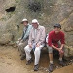
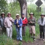
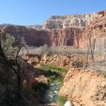
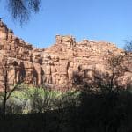
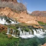
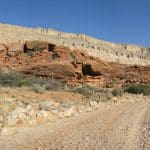
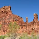
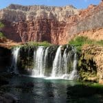
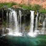
DAY 1 – Travel from Simi Valley to Supai Village, AZ and Havasu Falls Campground - - -The participants carpooled 465 miles to the trailhead at Hualapai Hilltop (5,187’) at the north end of Tribal Road 18 on the Hualapai Indian Reservation near the Grand Canyon (the route included I-40 east to Kingman, AZ and then Route 66 northeast to Tribal Road 18). Since there are no roads leading down into Supai Village on the Havasupai Indian Reservation, visitors (and residents) must hike, ride a horse, or ride in a helicopter to travel the 7.5 miles to the village. Electing to hike in, we followed the trail as it descended quickly 1,100’ to the bottom of scenic Hualapai Canyon with continuous views of red- and cream-colored sandstone cliffs and interesting rock formations. As we hiked down the canyon, we encountered many pack-mule trains heading up the canyon; in some cases the mules were not tied together, but were running free ahead of the wranglers, necessitating quick dashes to safety beside the trail. After hiking about six (6) miles we reached Havasu Canyon with dense stands of cottonwood, mesquite, and willow trees and lovely Havasu Creek with its blue-green water burbling along near the trail. Continuing downstream we soon reached dilapidated Supai Village (3,209’) where we checked in at the Tourist Office and paid entrance, environmental, and campground fees. After visiting the general store and the Supai Café, we continued hiking through town and then headed downstream two (2) miles to the entrance to the Havasu Falls Campground (2,848‘). Along the way we had our first views of stunning Nevada Falls (and cascades) and beautiful Havasu Falls; we took many photos. The campground stretches 0.6 mile from its entrance to the top of Mooney Falls. We selected a nice fairly secluded campsite on high ground about 0.4 mile from the campground entrance and set up camp. Each campsite had one or more picnic tables with benches. Drinking water was available at Fern Spring not far from the campground entrance and there were several very nice composting outhouse buildings located throughout the campground. The weather and temperature were perfect during our trip and the campground was sparsely populated (until the weekend) since it was very early in the tourist season. Havasu Creek provided a soothing “white noise” sound and we had no trouble falling asleep.
DAY 2 – Mooney Falls, Havasu Falls, and Nevada Falls – – –
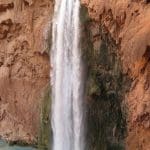
Activities included hiking to the base of Mooney Falls (the tallest of the waterfalls at 190’), spending time at spectacular Havasu Falls including enjoying the turquoise waters below the falls, and exploring the area around Nevada Falls (and cascades) and admiring its beauty. Havasu Falls and Nevada Falls are easily accessible from the dirt road linking Supai Village to the Havasu Campground, but descending to the base of Mooney Falls is another matter. A short distance from the top of the falls, the trail to the base of the falls enters a short tunnel as it continues downward, emerging onto a ledge about 120’ from the bottom (a chain provides a measure of safety). The trail then ducks into a second tunnel that emerges about 80’ above the canyon floor. From there it is a steep descent along rough-hewn steps using chains anchored into the rock face to provide handholds. The last 15’ of descent is made via two ladders (again chains are provided). There is a nice pool suitable for swimming at the bottom.
DAY 3 – Mooney Falls and Beaver Falls – – –
The primary activity on this day involved descending to the base of Mooney Falls and then following the stream for about three (3) miles to Beaver Falls (a series of cascades). The trail crosses Havasu Creek several times and requires getting wet (water shoes highly recommended). It is hard to follow at some points, but the direction is always downstream. Upon encountering a dangerously frayed rope and a fragile-looking ladder providing access to the base of the falls, the hikers decided not to risk the final descent and to return to camp. The main trail, however, continues on three (3) additional miles to the Colorado River in the bottom of the Grand Canyon.
DAY 4 – Havasu Falls, Nevada Falls, Supai Village, and Mooney Falls – – –
This was a leisurely day spent enjoying the beauty of the waterfalls/cascades, Havasu Creek, and the red sandstone canyon walls, exploring several side trails, and lunching outdoors at the Supai Café.
DAY 5 – Havasu Falls Campground, Supai Village, and travel to Simi Valley – – –
Rising early, we had a quick breakfast, packed our gear, and hiked the ten (10) miles [with an elevation gain of 2,300’] back up to Hualapai Hilltop, again dodging pack-mule trains from time to time (this time they were approaching us from behind). We headed home savoring the promise of hot showers, proper food, and soft beds, but extremely grateful for the opportunity to see and experience a very special part of planet Earth.
March 3rd 2012 – Backbone Trail Part 4: Encinal Canyon Road Trailhead to Latigo Canyon Road Trailhead Shuttle
On a warmer-than-usual winter morning 8 hikers carpooled from Simi Valley to the point at which the Backbone Trail (BBT) crosses Encinal Canyon Road in the Santa Monica Mountains. The trail immediately dropped into shady Trancas Canyon where it followed the stream up-canyon through a pleasant woodland. After crossing the stream on a second bridge, the trail began climbing to the east through chapparal and ceanothus. It then wound through upper Zuma Canyon, again providing lots of shade, until we reached Kanan Dume Road just north of tunnel #1. After a brief rest stop, we followed the trail as it led uphill to the south and then eastward over the tunnel and into more woods in Newton Canyon. At a high point on the trail we were treated to a panoramic view of the Pacific Ocean and several of the Channel Islands. We encountered various blooming wildflowers and lots of ferns along the heavily shaded trail. Eventually the trail rose to meet Latigo Canyon Road, across which we had parked our shuttle vehicles. We returned to Simi Valley having completed a 7.2-mile one-way hike with 1,756’ of elevation gain and 1,335’ of elevation loss.
February 25th 2012 – Backbone Trail Part 3: Backbone Trailhead (across from Mishe Mokwa Trailhead) to Encinal Canyon Road Trailhead Shuttle
On a pleasant winter morning 14 hikers assembled at the Simi Valley carpool point ready to tackle the third section of the Backbone Trail. The road to the trailhead wound through the Santa Monica Mountains providing lovely views along the way. The trail began at the edge of the parking lot directly across Yerba Buena Road from the Mishe Mokwa trailhead. As we headed east along the south flank of the mountain we encountered many bicycle riders and several runners. After several miles we reached paved Little Sycamore Canyon Road. There were good views of mountains, coastal valleys, the Pacific Ocean, and several of the Channel Islands. There were also a few early-blooming wildflowers along the trail. After a short walk along the paved road, the Backbone Trail continued along the Etz Meloy Motorway (an old dirt road); there were panoramic views to the north (toward the San Fernando Valley) and to the south (over the ocean). Eventually we left the old motorway and descended to Mulholland Drive via a fairly new section of the Backbone Trail, a wide gently sloping serpentine section that was built in 2006/2007 and opened to the public in late 2007. After crossing Mulholland Drive we stopped amid some pine trees and ate lunch. The final mile of the Day 3 hike led us along a pretty section of trail to our shuttle vehicles parked along Encinal Canyon Road, completing a 10.2-mile one-way hike with 858’ of elevation gain.
February 11th 2012 – Backbone Trail Part 2: Mishe Mokwa Trailhead to the Big Sycamore Canyon Trailhead Shuttle
Fourteen hikers carpooled to the northern (upper) end of Yuerba Buena Road at Triunfo Pass to hike the second section of the Santa Monica Mountains Backbone Trail (BBT) on a foggy chilly winter morning. The hike began at the Mishe Mokwa trailhead. The trail rose to the west through heavy chaparral to a junction with a short connector trail which led to the Sandstone Peak Trail which rose gradually for about a mile while providing spectacular views of the canyon to the north until it reached the spur leading up to Sandstone Peak. Despite the limited visibility, most of the hikers climbed to the peak (elevation 3,111’), the highest point in the Santa Monica Mountains. Returning to the main trail, we followed it to its junction with the Mishe Mokwa trail in a boulder-strewn valley. Continuing to the southwest on the BBT, stopping briefly at Inspiration Point, we soon passed two spurs leading to the Tri-Peaks area. The trail then descended to Chamberlain Rock (named for Henry Chamberlain, a beloved local who died in 1945). Continuing our descent we enjoyed panoramic views of Serrano Valley to the southwest and Big Sycamore Canyon and beyond to the west as well as a variety of blooming wildflowers along the trail. After a short lunch break, we soon reached the Old Boney Trail and followed it as it descended to the main fire road in the bottom of Big Sycamore Canyon. We then followed the fire road toward the ocean and eventually reached our shuttle vehicles in the Sycamore Canyon Campground parking lot, having completed a 12.7-mile hike with 1,400’ of elevation gain and over 3,000’ of elevation loss.
February 4th 2012 – Backbone Trail Part 1: Ray Miller Trailhead to the Big Sycamore Canyon Trailhead Shuttle
The nearly 70-mile-long Santa Monica Mountains Backbone Trail (BBT) winds through the Santa Monica Mountains National Recreation Area from the mouth of La Jolla Canyon in Point Mugu State Park to Will Rogers State Historical Park in Pacific Palisades. On its way it crosses three major canyons – Big Sycamore Canyon, Malibu Canyon, and Topanga Canyon. It travels along ridgelines that offer spectacular views of the Pacific Ocean, the Channel Islands, unique rock formations, deep canyons, and, given a normal rainfall, a dazzling array of wildflowers in season. It passes through grasslands, valleys, and oak woodlands and crosses seasonal streams.
On a clear cool winter morning, 11 hikers assembled near the Ray Miller trailhead in La Jolla Canyon in the Santa Monica Mountains, ready to embark on the first of eight Saturday day-hikes which will cover the entire Backbone Trail. As the Ray Miller trail climbed via gentle switchbacks up to the Overlook Fire Road, it afforded views of all of the Channel Islands except Santa Rosa Island and San Miguel Island. The mountainside was pleasantly green and a few wildflowers were blooming. The BBT (Backbone Trail) then followed the fire road to the Wood Canyon Vista Trail (also part of the BBT). Along the way the hikers were treated to panoramic views of La Jolla Valley to the west and Boney Mountain, Serrano Valley, and Big Sycamore Canyon to the east. The trail then descended into Big Sycamore Canyon, passing a variety of blooming flowers and trees, until it met the dirt road in the bottom of the canyon. The hikers took a lunch/rest break at the junction, taking advantage of the availability of drinking water (from a faucet), a nice log to sit on, and a good vantage point from which to watch the bicycle riders go by on their way up and down the canyon. As we resumed our hike and headed downstream toward our shuttle vehicles, we were serenaded by beautiful bright green South American birds in the bare sycamore trees (the birds are not native to the area, but were released or escaped into the wild some years ago). We eventually arrived at our shuttle vehicles, completing a 9.7-mile one-way hike with 1,100’ of elevation gain, and looking forward to hiking the second section of the BBT.
January 28th 2012 – Happy Camp Canyon – Middle Range Fire Road Loop
11 hikers met on a windy Saturday morning in Simi Valley to carpool to the dirt parking lot at the east end of Broadway Road north of Moorpark. The wind had subsided as we hiked one mile to the entrance to Happy Camp Canyon, “a lush riparian oak woodland with an intermittent stream.” We followed an old ranch road eastward as it rose gradually in the canyon bottom between Oak Ridge and Big Mountain. At 4.5 miles we passed an oak grove with picnic tables and hitching rails; we continued past it and climbed steeply for 0.5 mile up Big Mountain to the Middle Range Fire Road via an abandoned, partially eroded dirt road. Once we reached the ridge we were treated to distant views to the south and west including the Santa Monica Mountains and two of the Channel Islands. We were bedeviled by gale force winds for most of our return trip along the ridge. We eventually made it to the parking lot, having completed a 10.9-mile hike with 1,200’ of elevation gain/loss.
January 14th 2012 – Liebre Mountain via the Pacific Crest Trail
12 hikers carpooled to the Pacific Crest Trail (PCT) crossing (4,000’) on Pine Canyon Road (N2) a few miles south of Gorman, CA, stopping on the way to leave a shuttle vehicle on the Old Ridge Route Road (8N04); we were joined by a 13th hiker at the trailhead We followed the PCT as it rose gradually up Liebre Mountain through manzanitas, digger pines, and black oaks via long switchbacks; many large California buckeye shrubs had shed their chestnuts along the trail. After passing Horse Camp, the trail rose more steeply through a bigcone-Douglas-fir forest to unpaved Liebre Mountain Road (7N23) on the oak-dotted crest line (5,759’). Leaving the PCT, we headed west following an abandoned stretch of the PCT and then descended on the “Golden Eagle Trail” through a lovely forest until we again met 7N23. Somewhat disoriented, we confirmed our location and decided to descend 7N23’s long switchbacks to 8N04. We were aided in our descent by hitching rides from a couple of passersby, retrieved our shuttle vehicle, and eventually returned home, having completed a 12.1-mile hike with 2,010’ of elevation gain. The views from Liebre Mountain were fantastic, the scenery was beautiful, and it was a perfect day for hiking.
January 7th 2012 – La Tuna Canyon Park to Plantation Lateral
Fifteen hikers met at the Stearns Street Park & Ride and carpooled to the trailhead at La Tuna Canyon Park. It was a perfect hiking weather day with clear skies to the north, and low ground-hugging clouds to the south. We hiked up the shady side on the mountain, where there were new grasses growing and wishbone in bloom. When our small trail reached the fire road, there were large strategically placed lounge-chairs, affording a perfect place to enjoy the view out to the ocean on a clear day. After eating lunch, we proceeded to the very top of the mountain, where we saw a communications site with tall towers, antennas, cement foundations and a cistern. We hiked back down the same trail and carpooled back to Simi Valley. There are many more trails in the area, so we plan to return and do some exploring in the future.
